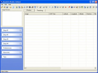
RoboGEO is a practical application that enables us to input geocoding data into maps, plans, routes, etc. This program provides a smart user interface with step-by-step instructions that makes it very easy to handle. First, we need to create a project and import a map or plan into this application. This program lets us import locations from many different sources, including GPS devices, Google Earth, etc.). We may also import one file or an entire folder. This program supports many popular digital image formats (PNG, JPEG, RAW, TIF, BMP, CR2, DNG, etc.).
We can also gather the geocoding data from various online sources, or from a NMEA/waypoint/tracklog file, IPTC fields, etc., or we can enter the data manually and add it to the image. We can edit the geocoding data, the time, view the metadata, etc. It is possible to add the location data to the EXIF headers or to the image itself, and also add audio to the image. After that we can save our project and export it to Google Earth, MapPoint, or Flickr, or export a DXF/GPX file, or a shapefield. All these features can be accessed both from the panel on the left and from the toolbar icons. This program can be evaluated for free. The trial version displays a bug made on purpose, so that the geocoding data differs slightly from the real one.


Comments